Deconstructing maritime maps: revealing map-making choices through fishing and recreational boating
By Juliette DAVRET
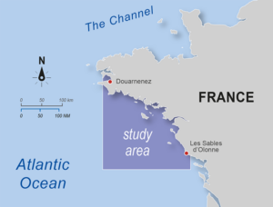
L’Atlas Bleu / Exploring
geo-technologies, cartography, critical GIS, fishing, recreational boating, spatial-temporal variability
Critical cartography has shown that maps are not neutral, yet they are a decision-making tool. This article uses the cases of fishing and recreational boating to explore possible map-making choices. These two distinct maritime activities, which are complex to map because of their spatial-temporal variability, provide an opportunity to address a wide range of cartographic issues. Data exist to describe fishing, but have limitations. Recreational boating, which is poorly monitored, lacks spatially mapped data. Exploring map-making choices based on the same dataset for each of these activities open up the black box of geographic information systems and reveals the influence of the choices made in data processing systems on the way maritime activities are represented.
Introduction
Using critical cartography and an exploratory approach, this article outlines the various mapping options that can be considered in the context of two specific activities: fishing and recreational boating.
The choice to focus on these two maritime activities is justified by their contrasting and complex nature. These two activities are characterised by their spatial dispersion and temporal variability. As a result, the data processing and representation choices made are subject to meanings that are raised by an interactive approach to map deconstruction based on the work of Davret (2023).
Figure 1: Variations in Map-Making of Fishing Activity
Fishing
Fishing activity has been studied in depth in the scientific literature, particularly in the context of Marine Spatial Planning (MSP) (see, for example, Said & Trouillet, 2020). This activity is characterised by various datasets, although the Automatic Identification System (AIS) and the Vessel Monitoring System (VMS) are mainly used on a global scale (Dupont, 2021).
In terms of mapping, fisheries are the subject of studies, on the one hand, to reveal the limitations inherent in cartographic representations and, on the other, to test possible alternatives (Trouillet, 2019). Although fisheries are monitored using various devices such as satellites, this monitoring is not harmonised. For example, the vessel segments monitored by these tracking systems vary from one country to another and are not necessarily representative of the active fishing fleet. In France, VMS is only compulsory for vessels over 12 metres in length (with a few exceptions), representing around 20% of the French fleet. Therefore, the majority of French vessels are not tracked and are not included in spatial analyses based on these data. Similarly, AIS is only mandatory under European regulations for vessels over 15 metres. Therefore, some of the fleet escapes surveillance, although quantifying and distributing this activity is crucial to planning (Shepperson et al., 2018).
To show a sample of possible maps of fishing activity, depending on the choice of data and processing, this article presents a selection of a dozen maps. This sample was drawn up on the basis of criteria identified in the scientific literature that are likely to influence the way in which fishing activity is represented (Figure 1).
Figure 1 shows a series of maps based on AIS data supplied by Global Fishing Watch (the only data available free of charge). This series of maps encompasses several versions, all starting with the same basic data, and varies according to several criteria: 1) the choice of spatial unit, 2) statistical calculations, and 3) time unit. Using these three criteria as parameters, a series of mappings is presented in order to allow in-depth comparative analysis (e.g. according to the types of fisheries, the type of graphical representation) and to give rise to a systematic evaluation of the effects of the prior choices on the final representation of the activity.
Figure 2 – Variations in Map-making of Recreational Boating Activity
Recreational boating
In contrast to fishing, monitoring data for recreational boating in France is very limited. Given that there is no requirement for satellite monitoring of light pleasure craft, i.e. those less than 20 meters long, it is particularly difficult to understand recreational boaters’ habits and to spatialise this activity for planning purposes (Brigand, 2004). From a critical cartography perspective, it is necessary to question the validity of the representations developed for an activity that has very limited information on the space in which it is deployed and which is based mainly on quantitative and terrestrial data (Nardin et al., 2008).
The series of maps dedicated to recreational boating has been developed on the basis of two hypotheses relating to two potential interpretations of the regulatory notion of ‘shelter’ for recreational boats1 (inspired by Tonini & Trouillet, 2005) and depending on navigation zones, in accordance with article 240 of the decree of 23 November 1987 concerning ship safety and pollution prevention (Figure 2). A first definition of ‘shelter’ (in a restricted sense) reduces shelters to marinas and mooring areas only while a second one (in a large sense) covers all coastal shelters like sandy beaches and artificial coastline such as docks.
Based on this, variations are proposed using two sets of data projected at sea: marina capacity and the number of registrations by maritime district. Using a double-entry table (depending on the data and the two definitions of ‘shelter’) and varying the grids, several map options are proposed to help the public make a critical reading of the possible interpretations of recreational boating activity.
Conclusion
The cartographic exploration undertaken in this study has highlighted the wide range of maps, and therefore ways of representing, that can be created for the same activity. Thus, each decision taken during the cartographic construction process has an influence on the way the activity is perceived through its representation. These choices encompass fundamental aspects such as the data used and the statistical operations employed, as well as elements of design, such as the colour palette chosen. Although all maps are in principle valid in terms of the criteria they reflect, they do not converge on a single optimal method of representation. So, there are many ways of representing, not just one single and unambiguous way.
In sum, this article highlights the crucial importance of challenging binary mapping and thus recognising the inherent complexity of marine activities. For balanced and informed marine spatial planning, it is essential to include map-making in the public debate, rather than considering it as an input or a finished product. Critical and participatory cartography offers a promising way of involving stakeholders throughout the data life cycle, increasing transparency, and providing more nuanced cartographic representations adapted to the real issues at stake.
1 – A ‘shelter’ is defined as a place such as a marina, mooring or any other sheltered area where a vessel and its crew can be brought to safety. In accordance with French regulations, navigation zones for recreational boating are defined in relation to a maximum distance from a ‘shelter’, which is a notion closely related to the boat itself.


Leave A Comment