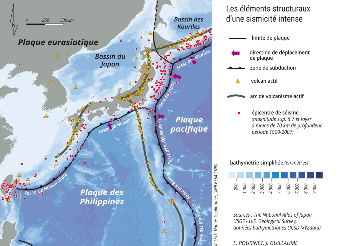
Japan: an example of an archipelago at high seismic risk
By Jacques Guillaume
L’Atlas Bleu / Preventing
Earthquake, tsunami, population, deadly disaster, Japanese archipelago.
This article presents a cartography of the main structural elements placing Japan in an intense seismic zone. It compares the population density of the archipelago with the inventory of earthquakes which occur over the 20th century. These elements show the vulnerability of this area. The example of the earthquake of march 11, 2011, reminds the chain of catastrophic events that led to the major nuclear accident in Fukushima.
Structural elements of intense seismicity…

…on a densely populated archipelago

In addition to the victims who died or went missing, more than 100,000 people were displaced which shows the level of disruption in those areas affected. To make matters worse, flooding at the Fukushima 1 nuclear power plant caused the cooling systems to shut down, leading to the meltdown of three reactors, a chain of explosions, and radioactive contamination in a populated zone which traditionally grew fruit and vegetables for the Greater Tokyo area. This made the incident one of the most serious nuclear disasters in history, alongside Chernobyl.


Leave A Comment