Habitat vulnerability to coastal flooding risks. The example of L’Épine (Vendée, France)
By Axel CREACH, Elie CHEVILLOT-MIOT and Denis MERCIER
L’Atlas Bleu / Living
Marine submersion, housing exposure, hazard, Xynthia, L’Epine, Vendée
Based on the example of a municipality of the Noirmoutier island (Vendée), the article examines the vulnerability of housing to the risk of marine submersion of the Xynthia storm type, in a context of coastal urbanisation in low-lying areas. The cartographic synthesis allows to compare the potential water level and the architectural character of each construction, and to determine the degree of exposure of the buildings of the different neighbourhoods of the municipality.

France’s coastal areas have seen increasing urban development since the 1950s due to the expansion of tourism and holiday resorts. This has placed significant pressure on the land and as an outcome, development has spread to low-lying and potentially flood prone areas.
Buildings have not been adapted ad hoc(e.g. by adding storeys or raising ground levels) to counterbalance this increased exposure. In Vendée and Charente-Maritime, single-storey houses predominate on new developments. This failure to adapt architecturally serves only to make residents more vulnerable, as the 41 victims of storm Xynthia in February 2010 remind us.
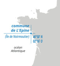
The district of l’Épine is a good illustration of these points. The first buildings were sited behind the sand dune ridge, near the salt marshes, at altitudes of 2.5 m to 5 m NGF. Newer developments have spread both onto the sand dune ridges (for the sea view) and low-lying areas in contact with the marshes, at altitudes below 2.5 m. In the absence of regulations, recent housing estates such as La Bosse or Bressuire (post 1970s) were built without any consideration for the risk of coastal flooding; this means that residents face a potentially high risk. In the event of coastal flooding of 4.2 m NGF, 1056 single-storey houses, i.e. almost 31% of all residences in the district, could be inundated by more than one metre of water.


Leave A Comment